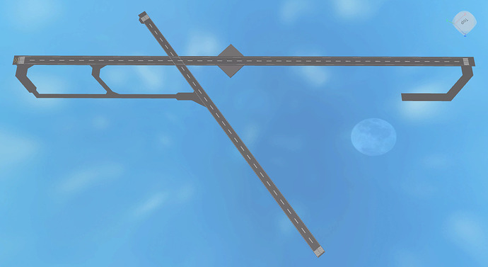
Hello there! I’ve started working on a building project aimed at recreating Quebec Jean Lesage Intl. Airport in Canada, but I am having issues getting the foundations covered. I have tried different techniques, but I’m not really satisfied with any of them. Here’s a rundown of what happened with each of the techniques.
Before we begin, please note:
- Proportions used: 1 ft = 1 stud
- No Blender, please. I’m not experienced in it or interested in modelling in it right now.
- These are heavy WIP and not all necessary details are present.
**Chapter 1: Manual measurements ft. Google Maps**
With this technique, I basically measured everything on Google Maps, using their “Measure distance” tool and then tried to recreate those measurements in Studio, without a direct visual reference in Studio itself.
For example, when building runway 06/24, I measured its length and width, then recreated the runway using those exact measurements. Since the measurements turned out to be approx. 9000 ft x 195 ft, I made the runway 9000 studs x 195 studs.
Problems:
- Although it’s, in theory, very accurate, since I don’t really have a visual aid, I have to do a lot of guesswork + trial and error. Plus, the small inaccuracies I get by not having a reference grow with each part I add. In the end, I end up with a wonky result with parts of the build not fitting properly.
- This technique is downright impossible to use with complex and curved shapes. How are you supposed to measure curved outlines with what is essentially a ruler?
Here’s how I far I got with the technique.
**Chapter 2: Section-by-section image reference ft. Google Maps**
With this technique, I started by taking screenshots of the area I wanted to build, bit by bit. Then, I imported these screenshots into Studio and started aligning them with each other and with what’s already built.
For example, in the area next to gates 33 to 37, the taxiway splits into two (see picture below).
I would trace the outline of the concrete area with parts before filling the interior in with said outline parts. Then, I would take screenshots for the next section and repeat the process.
Problems:
- Scaling and aligning each little screenshot to each other is too finicky and time-consuming. I keep running into issues where, for example, the Google Map zoom would be inconsistent between screenshots, forcing me to redo said screenshots or where the screenshots wouldn’t align correctly in Studio, even with the correct scaling.
No results screenshots because I deleted that part out of dissatisfaction and didn’t bother taking the pictures.
**Chapter 2.5: Single image reference ft. Google Earth**
Ok so, I can’t be bothered to take multiple screenshots, so what if I just take one huge screenshot and put that in Studio? So, I did just that.
But then, this revelation:
I’m not sure why the runway seems not straight. Is it because that’s how it is irl? Is it because of Google Earth’s… earth curvature? I don’t know. I just feel like giving up at this point.
I really am lost at this point, so I ask all great airport developers or really every developer out there… How do you manage to replicate irl buildings and infrastructure? Is there something wrong with what I’m doing? Am I just unnecessarily whining?
Edit: Oh yeah, this is my first post here, despite joining back in 2018.


