Hey all!
(I will create a seperate thread to put in #tutorials when this plugin is ready for the wild.)
I’ve been working on a plugin that I think is really cool. I made it because of some issues I had with the default tools involving how things like smoothing are handled, especially with usage of the grow and erode tool.
This plugin has a multitude of tools in it. The first one is a crude occupancy visualizer. It reads a region the user passes in and draws boxes to visualize occupancy. The outer black box is used to visualize grid space, while the inside colored box represents occupancy with both size and color.

This tool has proven to be very useful in situations when using the grow and erode tools.
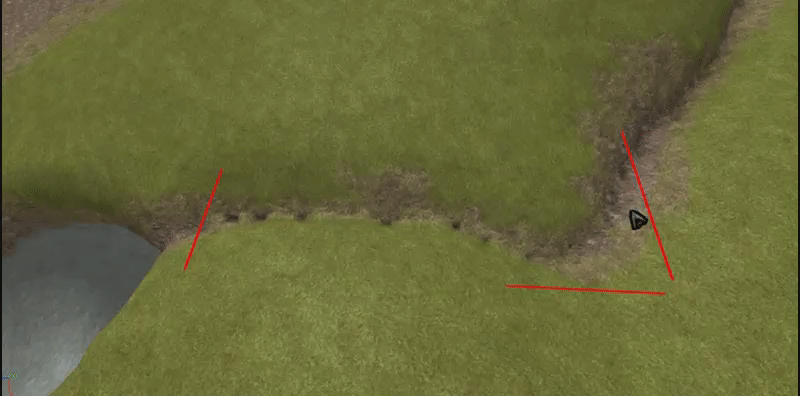
For instance, while something may look fine visually, the occupancy values are generally out of whack and can have some bad results when you have bits of terrain close to eachother, and we all know how much of a hassle that is to deal with. This is one of the more minor reasons that LOD can look strange on small, isolated sections of terrain, I’ve found. This is also the reason why using the smooth tool on hills causes little ridges to form.


Now, don’t get me wrong when I say this issue is a huge hassle at times. Who would I be to not design a feature to fix this?
The second part of this plugin is an occupancy calculator and editor. While this part isn’t QUITE yet complete, it has some interesting functions: An occupancy editor (and, with the editor, an automatic fixer / calculator)
The calculator and editor work together. Think of them as an automatic vs manual mode for this specific feature. When in the editor, the user will be able to click on a terrain voxel (likely one that has been highlighted with the visualizer, since I’m using BoxHandleAdornment). From then, a UI element will show. The user will be able to set a percentage value. This feature will allow you to fine-tune the occupancy of your terrain to ensure that it behaves as you want it.
As for the calculator, this is the feature that will be the most used, I think. In the calculator, the user will select a region of terrain they want to fix. From then, they can specify a threshold for how small voxels have to be in order to be affected. When they run it, the calculator will clear away any voxels within threshold (i.e. the ridiculously tiny ones shown in the image above).
What do you all think? I’ll have a release later today, probably.


